iHAB-8 - [Sat - Oct 27, 2012]
Mission Recap:
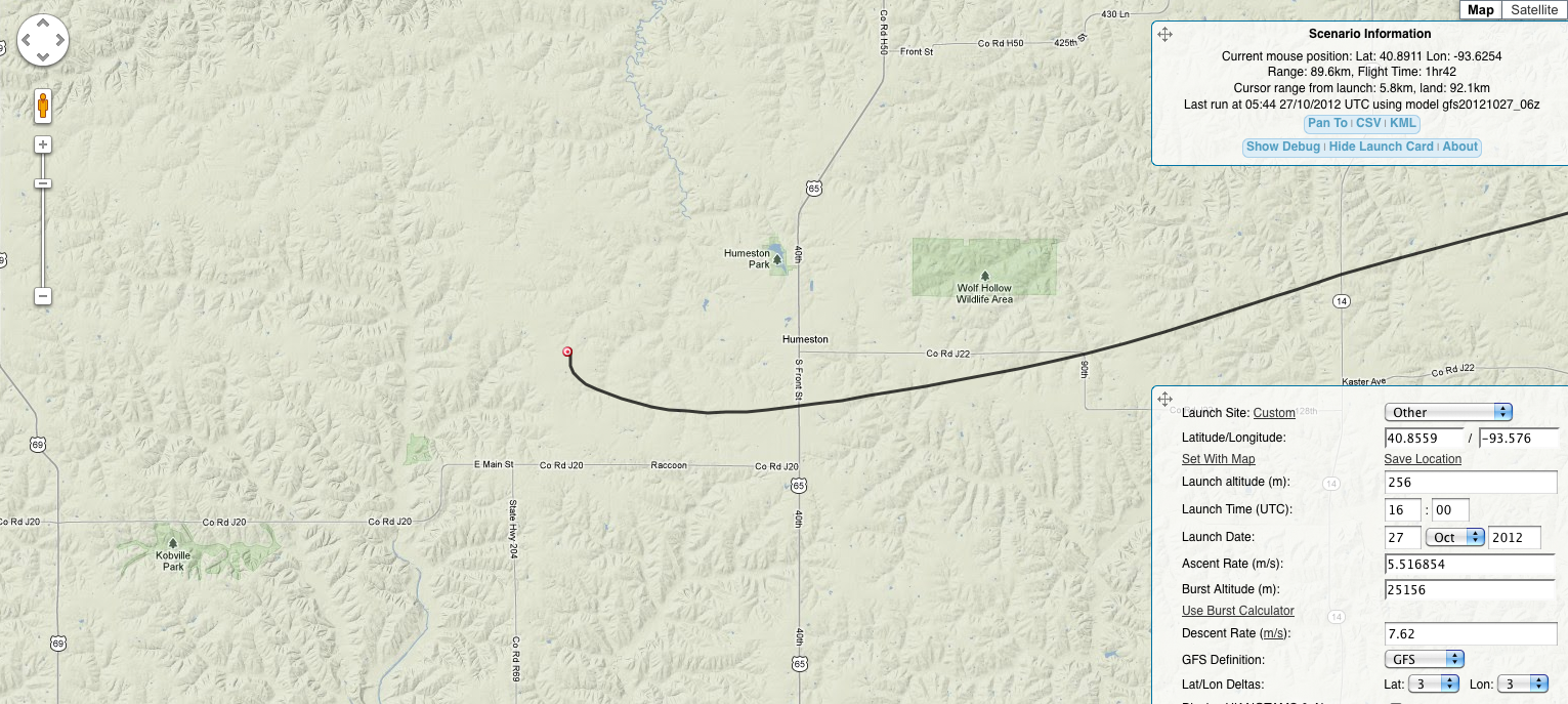
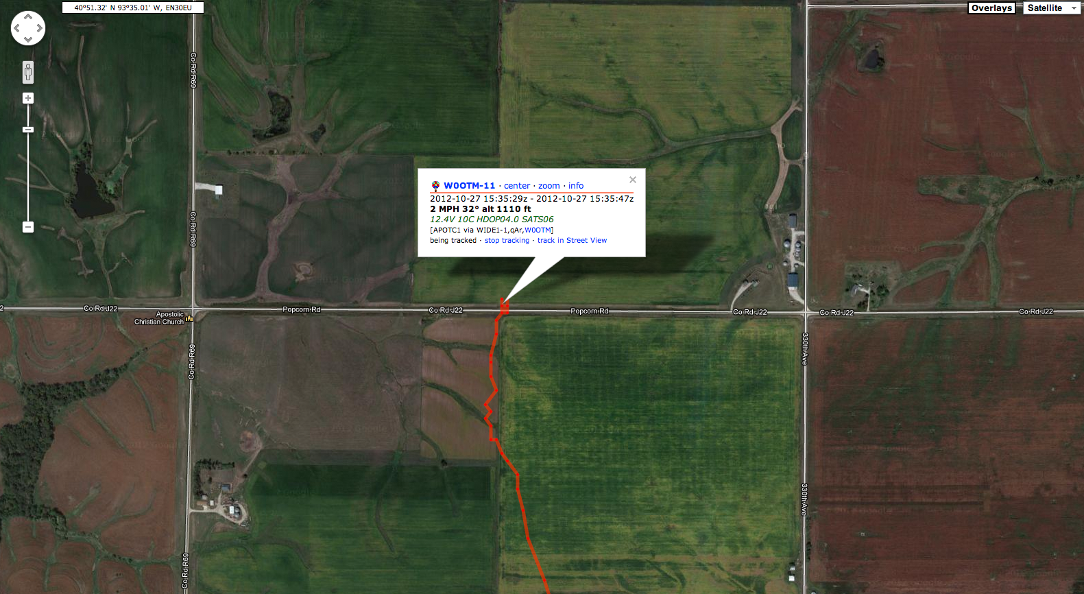
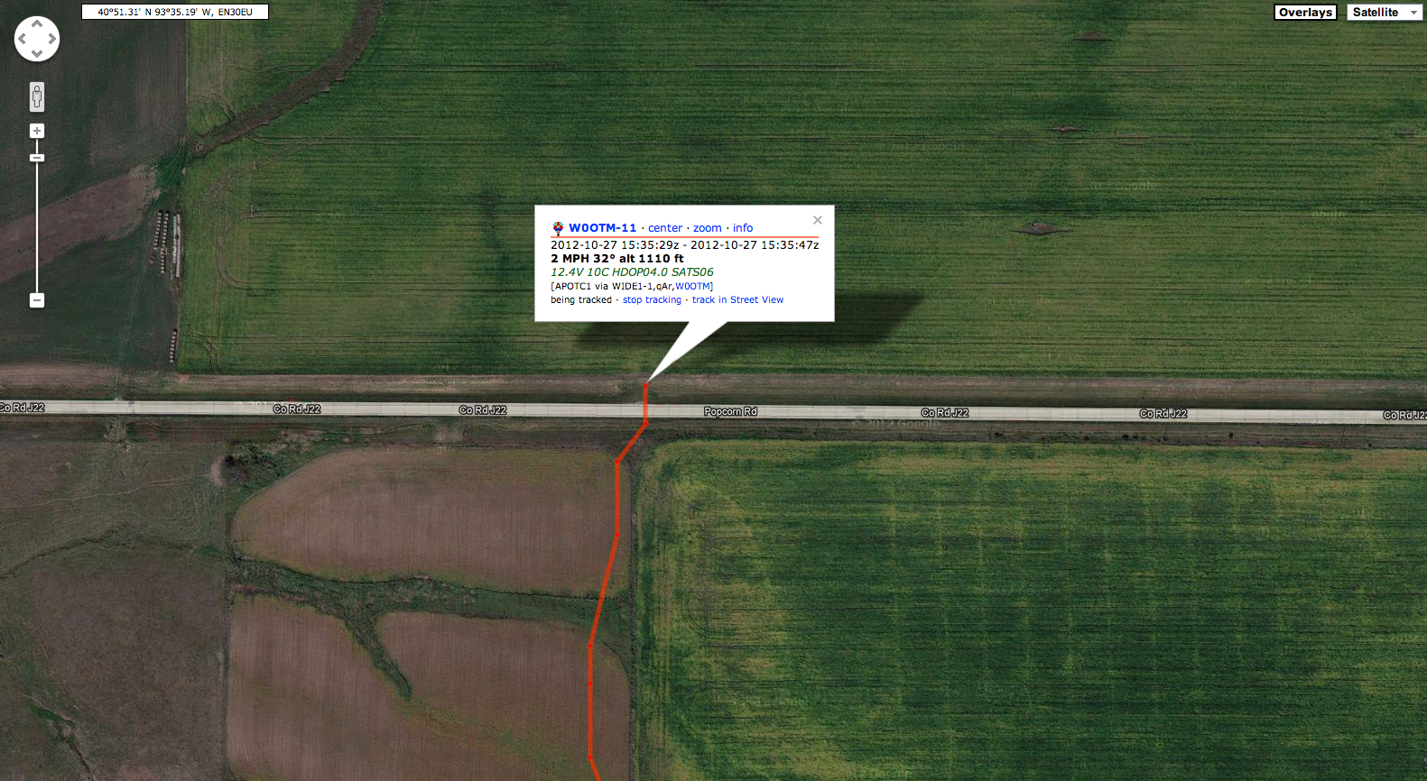
We launched iHAB-8 at 10:40am CST (1540Z) from a farm field off of County Road J22/Popcorn Rd in Humeston, IA. The iHAB Team was very confident in our launch location that we would land on the predetermined "X", at the Ottumwa Regional Airport. Shortly after the Propulsion Team began filling, we discovered that the helium tank which had been in storage since Spring 2012, was not fully pressurized. We required 124cu/ft of Helium to reach the desired 993ft/min ascent rate, but only had 75cu/ft. It was determined by the iHAB Team to move forward with the launch, knowing that we would NOT succeed at hitting our landing "X".
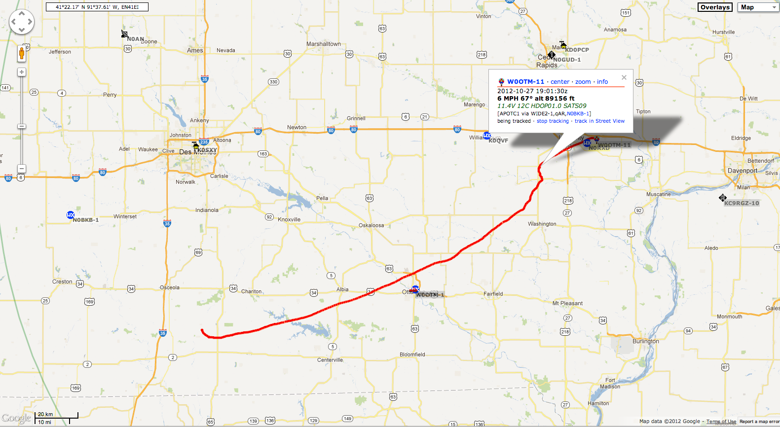
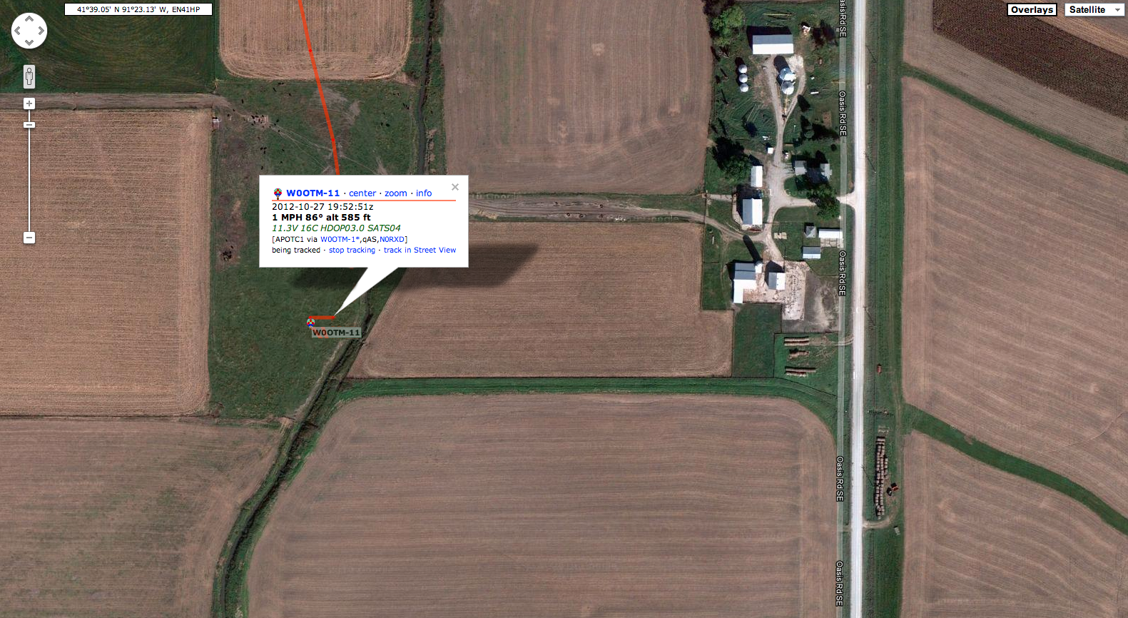
iHAB-8 staying aloft for 4 Hours - 2min, reaching a maximum burst altitude of 89,145ft and traveling 126.83 miles (204.11km, 110.21NM) down range.  iHAB-8 landed in a grassy field at 3855 Oasis Rd SE in West Branch, IA. Recovery was quick & easy, since corn fields in the area had been previously harvested, the team was able to obtain a visual of the capsule on the ground from the road.
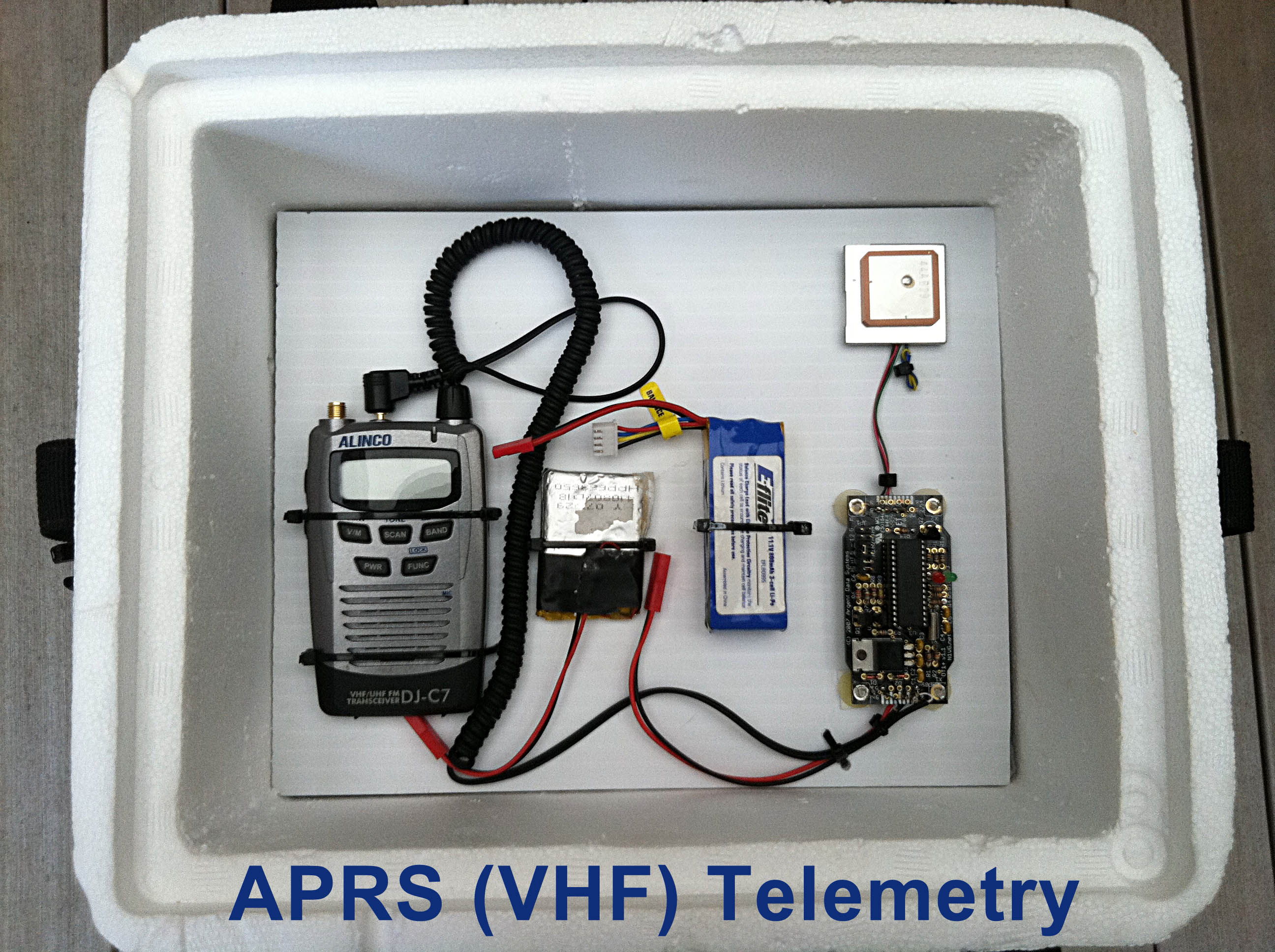
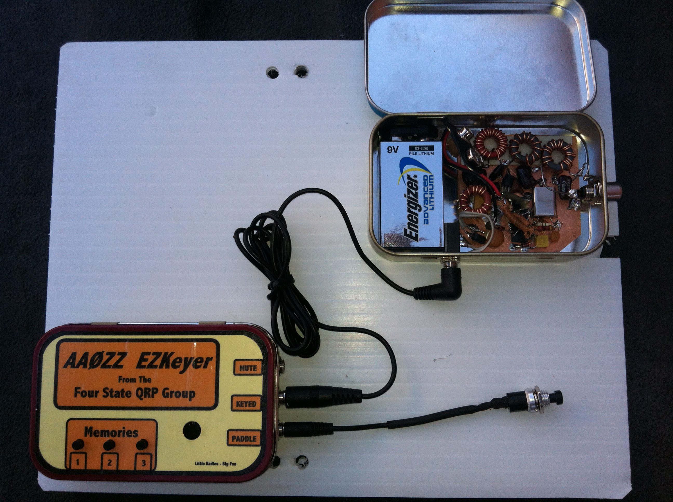
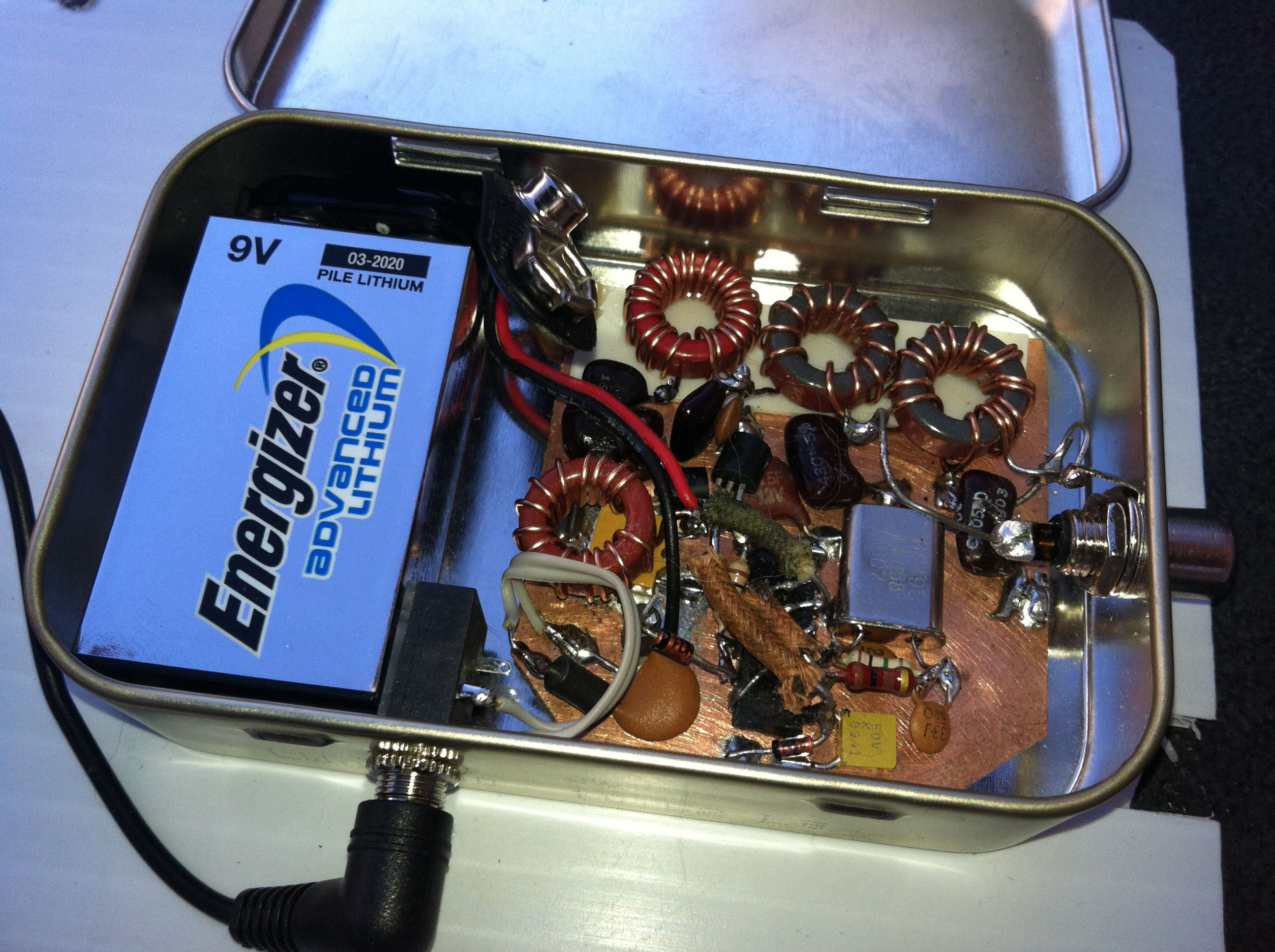
The 2ØM QRP Beacon was heard from coast to coast in North America. The 4SQRP AAØZZ EZKeyer v2 worked perfectly. User error caused the keyer to transmit "CQ CQ" repeatedly for the duration of the flight. (wonder how many people tried to answer) If you have signal reports please email them to me. Thanks to Dave Cripe for the build! We plan to fly this same radio again in iHAB-9.
A special thank you to to Paul Carwright (WA0PAC) - and PJ Cartwright (WA0PJC) for your help in Preflight activities, and iHAB-8 Launch!
iHAB-8 - Mission Goals
 Select a launch location that will result in a predetermined landing location - the "X" (Ottumwa Regional Airport)
 Fly a new 20M mico HF beacon. Designed and built by Dave Cripe NM0S.
 Fly a new HF antenna OCF DiPole design.
- Fly HD Video/Photo equipment.
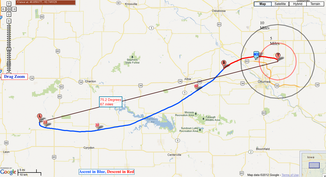
iHAB-8 - Flight Prediction
-
Launch:
- Call: W0OTM-11
- Sunrise: 7:40a.m.
- Sunset: 18:16p.m.
- Launch: 11:00:00
- On: 2012-10-27
- Lat: 40.8559
- Lon: -93.576
- Base Elev: 750 ft.
- Using GFS from OTM*
- Requested --
- Ascent: 993 ft/m
- Max Altitude: 82514 feet
- Descending: 1500 ft/m
-
Burst:
- At: (41.06563, -92.61861)
- Max Alt.: 82150 feet
- Radio Horizon: 353 miles
- Flight Time T+: 83 minutes.
- Down Range: 52 miles.
-
Touchdown:
- At: (41.09518, -92.33705)
- Total Time T+: 109 minutes.
- Bearing: 75.2 deg
- Down Range: 67 miles.
iHAB-8 - Flight Recap
Recovery was successful!
Burst Altitude: 89,145ft
Flight Duration: 4hr2min
Landed south of West Branch, Iowa
iHAB-8 Launch Video
Flight Analysis |
 |
 |


