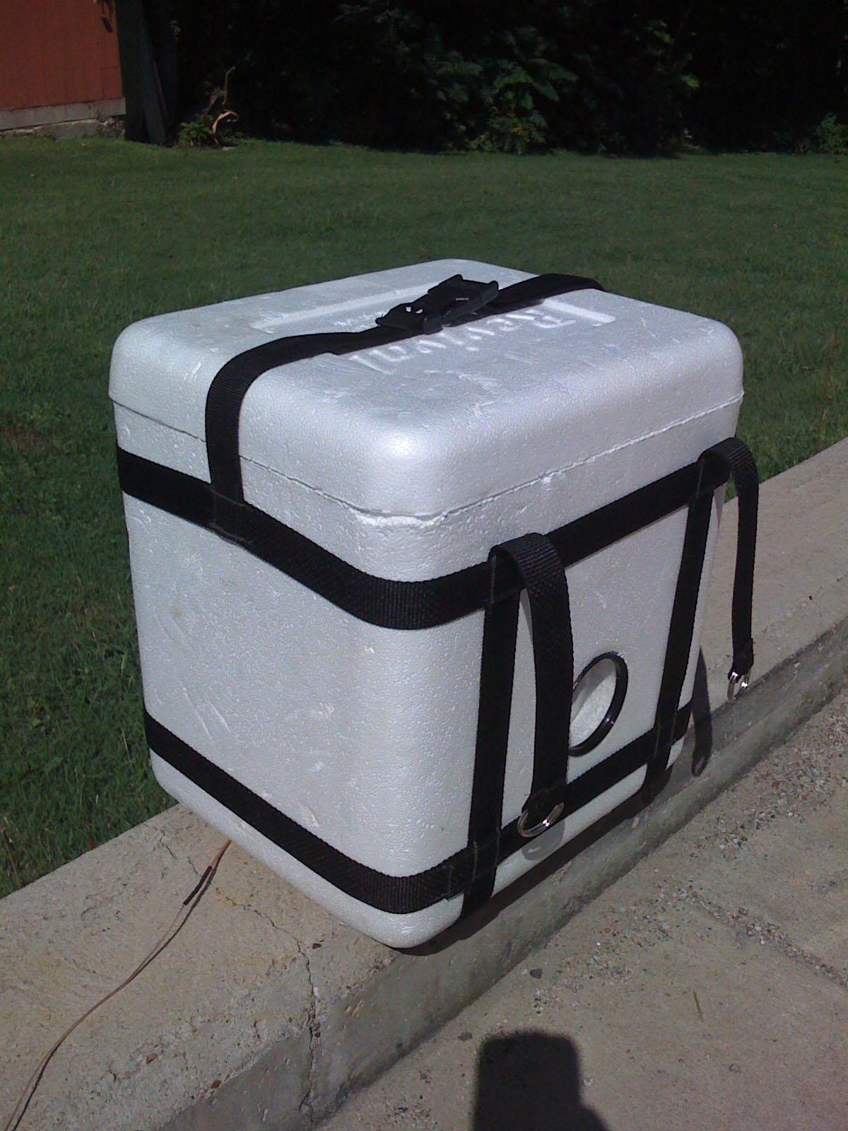
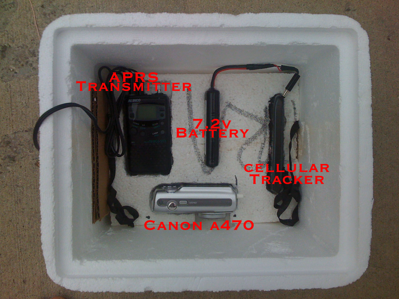
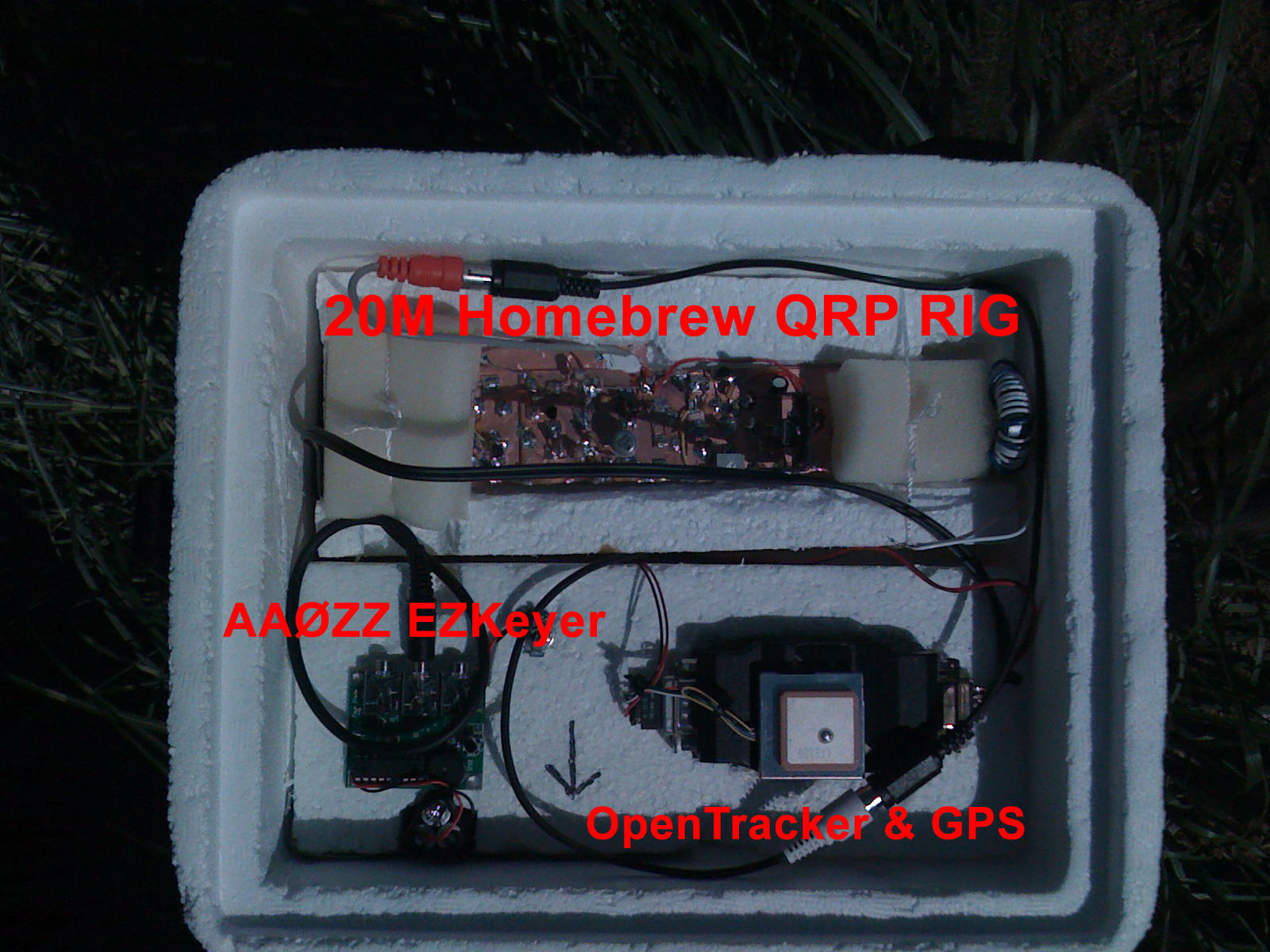
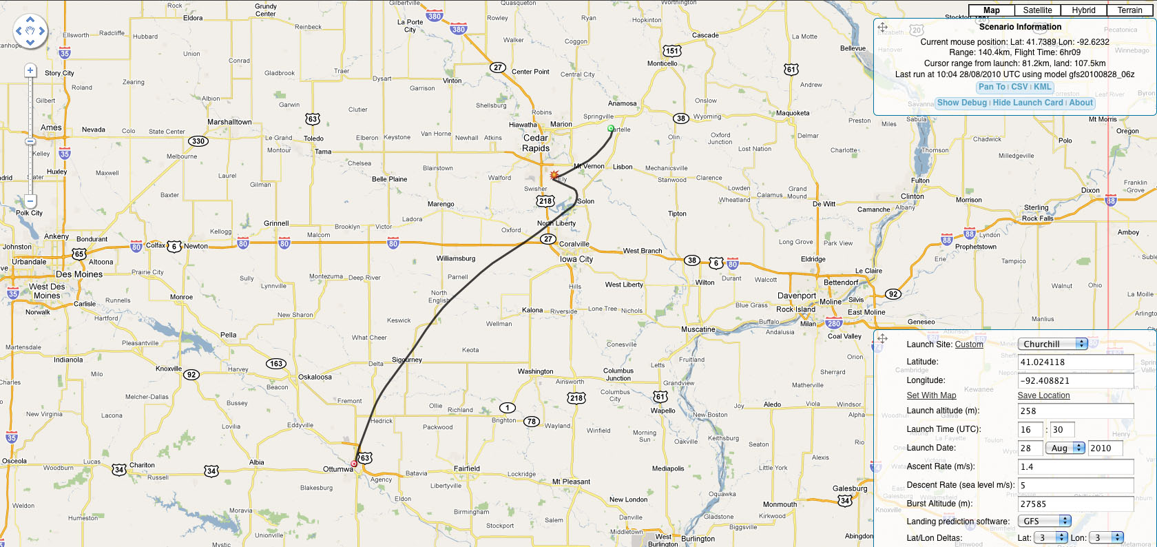
iHAB-1

Saturday - August 28th 2010
Flight Duration: 5 hours 28min
Maximum Altitude: 84,400ft


84,400ft - Highest Altitude

iHAB 1 - Flight Prediction


As of - Fri Aug 27 17:19:13 CDT 2010

Range: 31.3km (19.4mi)
Flight Time: 3hr13

Maximum Altitude - 90,481ft (17.15mi)

Predictive Map #1

Predictive Map #2

iHAB 1 - Flight Recap

Flight Duration: 5 hours 28min
Maximum Altitude: 84,400ft


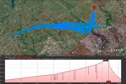
APRS Data file for Google Earth click here


Audio Clips of CW beacon on 20 Meters

From N0JL - Ottumwa, IA LISTEN
From VE7SL - Mayne Island B.C. @ 1531Z LISTEN

From VE7SL - Mayne Island B.C. @ 1805Z LISTEN


Media Relations

Pre-Launch Video


Launch Video

HiDef Version


eHAM Article : http://www.eham.net/articles/24466

QRZ Forums : http://forums.qrz.com/showthread.php?t=261227


iHAB-1 Flyer (PDF)


Content on this page requires a newer version of Adobe Flash Player.

Get Adobe Flash player

WHOtv13 - http://www.whotv.com


Content on this page requires a newer version of Adobe Flash Player.

Get Adobe Flash player


KTVO - http://www.heartlandconnection.com/news/story.aspx?id=503622
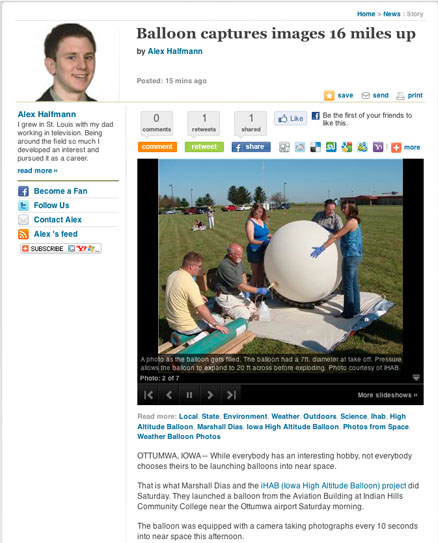
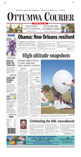


Ottumwa Courier
http://ottumwacourier.com/local/x87451749/High-altitude-snapshots-Helium-balloon-floats-17-miles-high-and-takes-pictures-of-Earth


stats counter